


|
|
C&O Milepost 161.9
The Bakers Creek station was located near bridge 1619. I do not believe that there was ever a depot of any kind there; Bakers Creek was not listed on any employee or public timetables in my possession. The first mention that I can find for it is the July 1921 List of Officers, Agents, and Stations. It was listed as a pumping station on the 1946 valuation.
Most maps don’t name the small stream that the bridge spans, but the C&O Valuation maps call it Bakers Creek. The creek was most likely named for Martin Baker. Baker purchased part of the Gordon land (including the tavern, see the Gordonsville page) in the fall of 1830. Baker then acted as the post master for Gordonsville and Baker Street still exists in Gordonsville. Also, as late as 1903, Carver’s Mill still stood near Gordonsville. Carver’s Mill had previously been Baker’s Mill.
The C&O built a water station and facilities at Bakers Creek in 1924. In 1932 the company added a pumping station and reservoir. The water facilities were donated to the town of Gordonsville in 1955. The C&O Index of Stations and Tunnels (1943, updated to 1969) noted that Bakers Creek did not appear on the official station list in 1928. The 1963 track charts show only bridge #1619 and a pump house there. In 1980 a siding was built at Bakers Creek to serve the new Klöckner Pentaplast plant. The siding was extended in 1992.
Photos |

This is bridge #1619, the Bakers Creek bridge. To the left is a large pond that most likely was a mill pond. The creek flows under the bridge and past part of the large Klöckner Pentaplast plant. (November, 2002 photo by Larry Z. Daily)

This is the pond on the west side of the tracks in Bakers Creek. The creek feeds into the pond across from the tracks and exits under the bridge shown above. (November, 2002 photo by Larry Z. Daily)
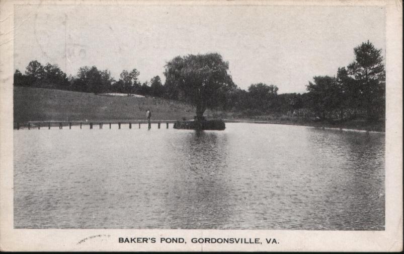
This image is from a postcard labeled Baker’s Pond, Gordonsville, VA. The card was mailed in July 1917 to a Master Karl Engle who was staying at the Exchange Hotel in Mt. Joy, Pennsylvania. The writer (F. Swain Wingfield) wrote, “This is the pond where Gordonsville boys bathe. We have no creek or river.” (From a postcard in the the collection of Larry Z. Daily)

At milepost 162 a siding now splits from the main to serve the Klöckner Pentaplast plant. The plant was built in the eatly 1980’s. (November, 2002 photo by Larry Z. Daily)

Covered hoppers on the Klöckner siding. (November, 2002 photo by Larry Z. Daily)
Map |
This map was prepared from U.S.G.S. topological maps, C&O track charts dated 1963, C&O Side Track Records dated 1937, a copy of the Side Track Records updated through the 1990’s, and C&O Valuation maps, also updated through the 1990’s.

Stations |
|
You are visitor number
to this site since the new counter was inaugurated on June 28, 2004.
This site was originally established in 1997.
| Mail comments to: | Larry Z. Daily |
Please note that, due to a huge volume of spam coming in on my email account, I’ve had to change my email address. The new address is lzdaily@nospam.piedmontsub.com (but remove the nospam and the dot before piedmontsub.com).
Copyright © 1997-2025 Larry Z. Daily. All rights reserved.
All materials on this Web site are protected by United States
copyright law. This includes, but is not limited to, articles and graphics. Unless
otherwise indicated, these materials are the property of Larry Z. Daily and may not
be used without prior written permission of Larry Z. Daily